
Community
Storm chances continue through the weekend, drier air returns soon. Here’s when
By Marcus Chen
ClickOrlando Local
Advertisement

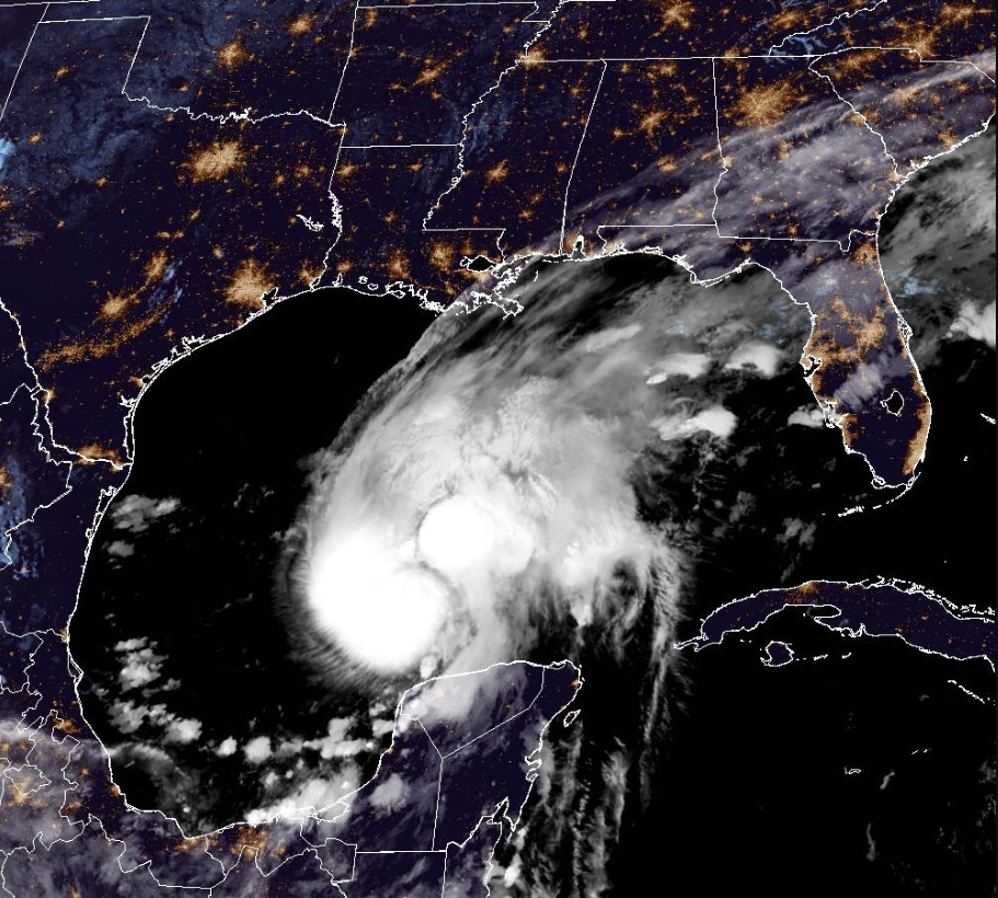
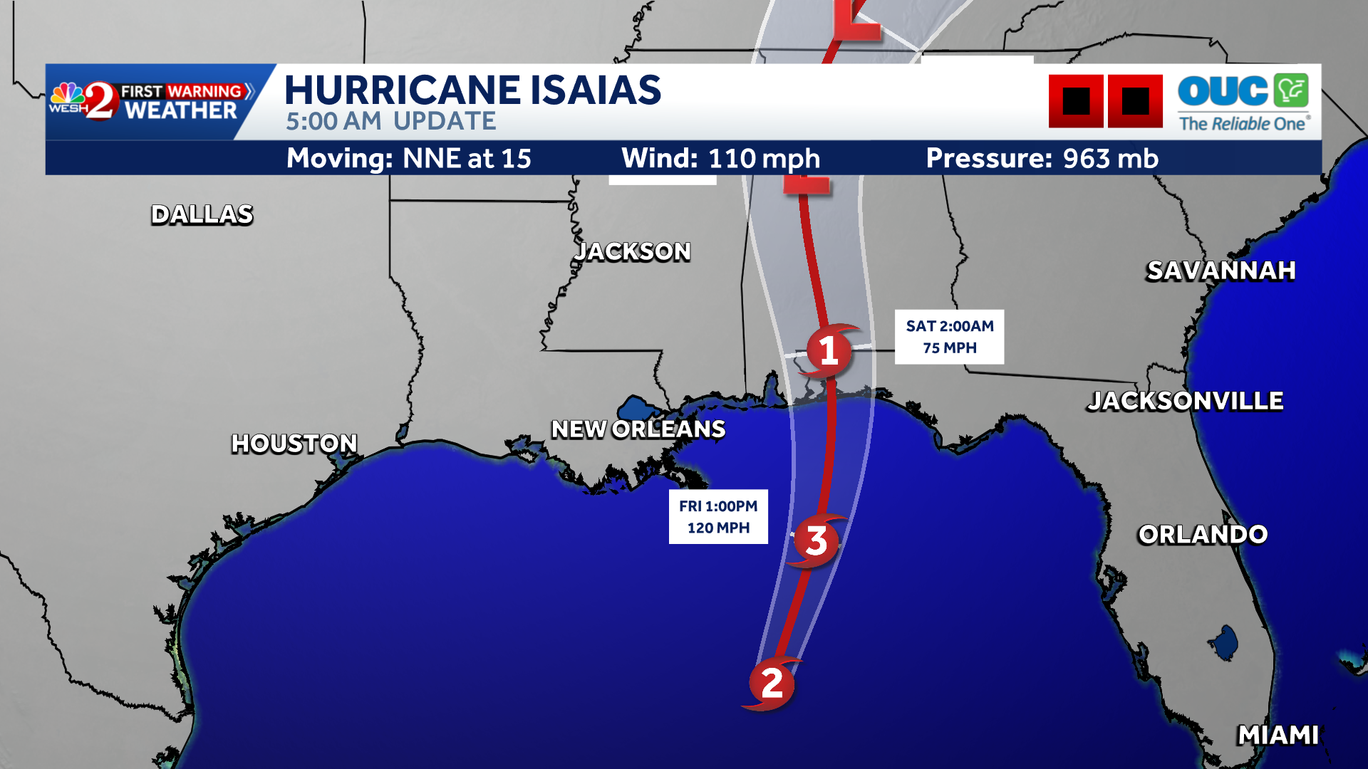
Hurricane Isaias strengthened overnight and is nearing major hurricane status as it moves toward the northern Gulf Coast. Life-threatening storm surge, damaging winds and flooding rain are expected across the Florida Panhandle and parts of the Southeast as landfall approaches tonight or early Saturday.Latest updateAs of the latest update, Isaias had maximum sustained winds of 110 mph and was moving north-northeast at 15 mph. Hurricane Hunter aircraft have reported stronger winds and a better-defined eye as the storm intensifies over very warm Gulf waters.Isaias is expected to become a major hurricane this morning and could continue strengthening for several more hours. Increasing wind shear before landfall should cause some weakening, but Isaias is still forecast to remain a dangerous hurricane as it reaches the coast.Gulf Coast threatA Hurricane Warning remains in effect from Ocean Springs, Mississippi, to the Bay/Gulf County line in Florida. A Storm Surge Warning extends from the mou
By Marcus Chen
ClickOrlando Local

By Katherine Langford
FOX 35 Orlando
By Katherine Langford
WESH 2 Orlando
By Marcus Chen
WESH 2 Orlando